![]()
Landforms in geography: Meaning, Types, and How They Are Formed

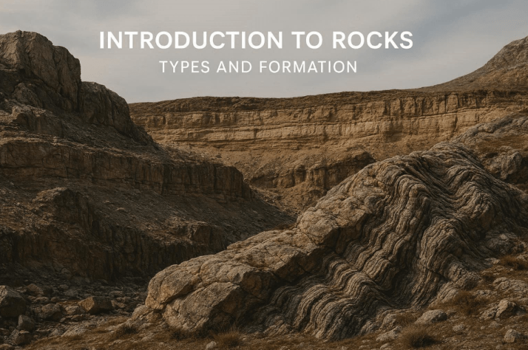
Landforms are the natural physical features that shape the surface of the Earth, including mountains, valleys, plains, plateaus, hills, and many other features we see around us. In geography and earth science, landforms in geography are important because they help explain how the Earth’s surface looks the way it does and how natural environments influence climate, water movement, ecosystems, and human activities. From towering mountain ranges to wide river plains, landforms play a central role in shaping landscapes and guiding where people live, farm, travel, and build cities.
These features are not random or static. Landforms are created and continuously modified by powerful internal Earth processes such as plate tectonics, volcanism, folding, and faulting, as well as external processes like weathering, erosion, transportation, and deposition by water, wind, ice, and gravity.
Together, these forces work over millions of years to build, reshape, and sometimes destroy landforms. In this article, you will explore the meaning of landforms, how they are classified, the key processes responsible for their formation, real-world examples from different environments, and why understanding landforms is essential to both physical geography and human life.
What Are Landforms?
Landforms are the natural physical features found on the Earth’s surface, created by long-term geological and geomorphological processes. In geography, landforms are defined as naturally occurring shapes of the land, such as mountains, valleys, plains, plateaus, hills, rivers, deserts, and coastlines. These features vary widely in size, shape, height, and origin, but they all result from the interaction of internal Earth forces and external surface processes acting over time.
It is important to distinguish between landforms and landscapes. A landform refers to a single physical feature, such as a mountain or a valley, while a landscape describes a broader area made up of many landforms combined with vegetation, water bodies, and sometimes human features. For example, a mountainous landscape may include peaks, valleys, rivers, and plateaus working together as one visual and physical system.
Landforms in geography are studied because they provide key insights into how the Earth works. By studying landforms, geographers can understand past and present geological processes, identify areas prone to natural hazards, explain climate and drainage patterns, and analyze how physical environments influence human settlement, agriculture, transportation, and resource use.
Understanding landforms also helps students and researchers interpret maps, satellite images, and field observations, making landforms a foundational concept in physical geography and earth science.
How Landforms Are Formed
Landforms are the visible results of continuous Earth processes that operate both deep within the planet and at its surface. In physical geography, the formation of landforms is explained by the interaction between internal Earth forces that build and uplift the crust, and external forces that wear it down and reshape it over time. Understanding how landforms are formed helps explain why mountains rise, valleys deepen, plains spread out, and coastlines constantly change. These processes do not act in isolation; instead, they work together over geological time to create the diverse landscapes found across the Earth’s surface.
Internal (Endogenic) Processes
Internal or endogenic processes originate from within the Earth and are mainly driven by heat from the Earth’s interior. One of the most important internal processes is plate tectonics, which involves the slow movement of large lithospheric plates. When these plates collide, pull apart, or slide past one another, they generate powerful forces that deform the Earth’s crust. Compression at convergent boundaries leads to folding and mountain building, while tension at divergent boundaries causes crustal stretching and faulting.
Volcanism is another major internal process responsible for landform development. When magma rises from the mantle and erupts at the surface, it creates volcanic landforms such as cones, lava plateaus, and volcanic islands. Folding and faulting also play key roles in shaping landforms by bending rock layers or breaking them along fractures, leading to features such as fold mountains, block mountains, rift valleys, and fault scarps. Through crustal uplift, entire regions can be raised to form plateaus and highlands, laying the foundation for many major landforms seen today.
External (Exogenic) Processes
External or exogenic processes act on the Earth’s surface and are responsible for modifying, reshaping, and sometimes destroying landforms created by internal forces. These processes are powered mainly by solar energy and gravity. Weathering is the first step, involving the breakdown of rocks in place through physical, chemical, and biological actions. Once rocks are weathered, erosion removes the loosened material and transports it away from its original location.
Transportation and deposition follow erosion, as materials are carried and eventually laid down elsewhere to form new landforms. Water, wind, ice, and gravity are the main agents of these external processes. Rivers carve valleys and deposit sediments to form floodplains and deltas. Wind shapes deserts by creating sand dunes and eroding rock surfaces.
Glaciers sculpt rugged landscapes, forming features such as U-shaped valleys and moraines, while gravity drives mass movements like landslides and rockfalls. Together, these external processes constantly reshape the Earth’s surface, proving that landforms are dynamic features that evolve over time rather than permanent structures.
Why Rocks, Hills, Valleys, and Mountains Are Often Confused
Many people use the word mountain to describe almost any high or rocky landscape. A steep hill, a massive rock outcrop, a raised plateau, or even the edge of a deep valley is often casually labeled a mountain. In everyday language and communications, this confusion is understandable. In geography and earth science, however, each of these features is a distinct landform, defined by its height, slope, relief, size, and formation process.
A single rock is not a mountain, just as every elevated area is not automatically a hill or a plateau. This confusion is exactly why geographers classify landforms systematically. In this article, you will learn how landforms are identified, grouped, and explained scientifically, so you can clearly tell the difference between mountains, hills, valleys, plains, and other features of the Earth’s surface.
Classification of Landforms

Landforms can be grouped in different ways to make them easier to understand and study. In landform classification in geography, geographers commonly classify landforms based on their origin and scale. Classification by origin focuses on how a landform was created, whether by internal Earth processes such as tectonic movement and volcanism, or by external processes like erosion, weathering, and deposition.
Classification by scale, on the other hand, looks at the size and extent of landforms, ranging from large features that dominate entire regions to smaller features that shape local landscapes. This approach helps students and researchers clearly identify landforms, understand their formation processes, and explain their role in shaping the Earth’s surface.
Major Landforms
Major landforms are the largest and most prominent features on the Earth’s surface. They extend over wide areas and strongly influence climate, drainage patterns, vegetation, and human settlement. There are three main major landforms in geography, they are:
- Mountains
Mountains are large natural elevations of the Earth’s surface characterized by steep slopes, high relief, and significant height above the surrounding land. They are formed mainly through tectonic processes such as plate collision, folding, faulting, and volcanic activity. Mountains often act as natural barriers to human movement, influence climate by affecting rainfall and temperature, and serve as important sources of rivers and biodiversity. - Plateaus
Plateaus are elevated landforms with relatively flat or gently undulating surfaces that rise above the surrounding areas. They can form through volcanic lava flows, tectonic uplift, or the long-term erosion of surrounding landscapes. Although plateaus are high like mountains, they lack sharp peaks and steep slopes. Many plateaus are important for grazing, mineral resources, and human settlement due to their broad, stable surfaces. - Plains
Plains are extensive, low-lying or gently sloping areas with minimal relief. They are commonly formed by the deposition of sediments carried by rivers, wind, glaciers, or coastal processes over long periods of time. Plains are among the most fertile and densely populated regions of the world because their flat terrain supports agriculture, transportation, and urban development.
Minor Landforms

Minor landforms are smaller-scale features of the Earth’s surface, but they play an important role in shaping landscapes and influencing human and ecological activities. Unlike major landforms, they are more localized and often formed mainly by erosion, deposition, or limited crustal movement.
- Hills
Hills are raised areas of land with gentle to moderate slopes and lower elevations than mountains. They are commonly formed through erosion of larger landforms, sediment deposition, or minor tectonic uplift. Hills are widespread and often support agriculture and human settlements. - Valleys
Valleys are elongated low-lying areas found between higher ground such as hills or mountains. Most valleys are formed by the erosive action of rivers over long periods, creating V-shaped valleys, or by glaciers, which produce broad U-shaped valleys. Valleys often contain fertile soils and serve as important routes for rivers and transportation. - Basins
Basins are depressions in the Earth’s surface where water and sediments tend to accumulate. They may form through tectonic subsidence, erosion, or volcanic activity. Basins often host lakes, wetlands, or inland drainage systems and can be important centers for agriculture and settlement. - Dunes
Dunes are mounds or ridges of sand formed by the action of wind, mainly in desert and coastal environments. Their shape and size depend on wind direction, sand supply, and vegetation cover. Dunes are dynamic landforms that can migrate over time and significantly influence local ecosystems and human activities.
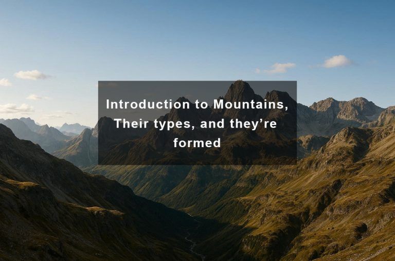
Mountains as Landforms
Mountains are one of the most prominent and easily recognized landforms on Earth. They are elevated portions of the Earth’s surface that rise sharply above their surroundings, characterized by steep slopes, high relief, and significant height. As landforms, mountains play a major role in shaping climate, controlling river systems, influencing biodiversity, and affecting human settlement and activities.
From a geographical perspective, mountains are commonly classified based on how they are formed. This includes fold mountains, created by the compression and collision of tectonic plates; volcanic mountains, built up by repeated lava flows and volcanic eruptions; block mountains, formed through faulting and crustal movement; and residual mountains, which are the eroded remains of ancient mountain systems. Each type reflects a different geological process acting on the Earth’s crust.
The formation of mountains is closely linked to tectonic forces and volcanism. Movements within the Earth’s interior drive plate tectonics, leading to uplift, folding, and faulting, while volcanic activity builds mountains from magma rising from deep within the mantle. Together, these internal Earth processes explain why many of the world’s major mountain ranges are found along plate boundaries and zones of intense geological activity.
👉 Want a deeper understanding of how mountains form and their different types? Explore our full guide on Mountains: Types and How They Form to see how tectonics, volcanism, and erosion shape some of the most dramatic landscapes on Earth.
Volcanic Landforms
Volcanic landforms are surface features created by volcanic activity, making them some of the most dynamic and visually striking landforms on Earth. They form when magma from deep within the Earth rises to the surface, erupts as lava, ash, or gases, and then cools and solidifies. These landforms clearly demonstrate how internal Earth processes shape the planet’s surface over both short and long geological timescales.
One of the most common volcanic landforms is the volcanic cone. Volcanic cones develop around volcanic vents as layers of lava, ash, and pyroclastic materials accumulate over repeated eruptions. Depending on the nature of the eruptions, these cones may be steep and explosive in form or broad and gently sloping, reflecting differences in magma composition and eruption style.
Another major volcanic landform is the lava plateau. Lava plateaus form when highly fluid lava flows spread over wide areas through fissures or cracks in the Earth’s crust. Over time, successive lava layers build up extensive, flat or gently undulating surfaces. These plateaus can cover thousands of square kilometres and significantly alter regional landscapes.
Calderas are large, basin-like volcanic landforms created when a volcano collapses after a massive eruption empties its magma chamber. Unlike typical craters, calderas are much wider and can later become sites for lakes, renewed volcanic activity, or fertile soils that support vegetation and human settlement.
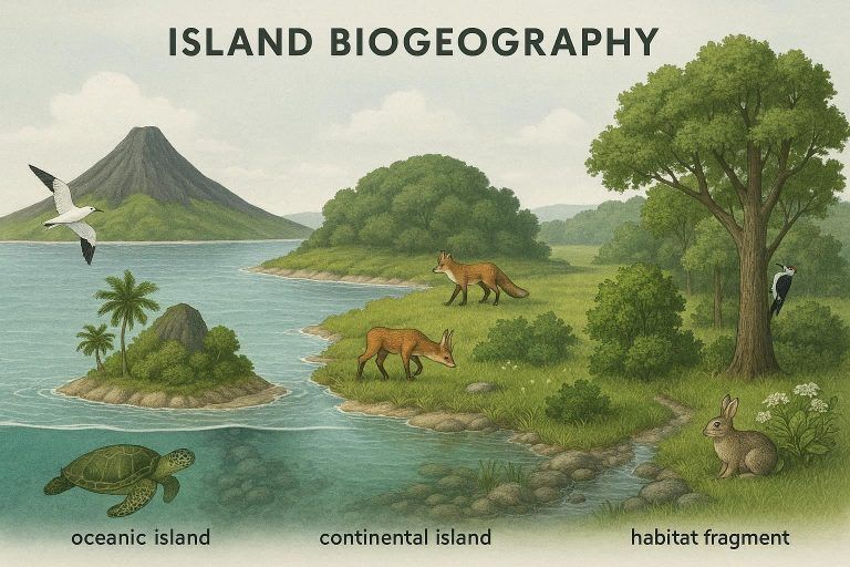
Volcanic activity can also give rise to volcanic islands, which form when eruptions occur beneath the ocean and gradually build up land above sea level. These islands often begin as lifeless surfaces but later develop ecosystems as plants and animals colonize them. Volcanic islands provide important examples for studying landscape evolution, ecological succession, and island biogeography.
👉 To understand the processes behind eruptions and how volcanoes create these landforms, explore our detailed guide on Volcanoes: Types, Formation, and How They Work, where we break down volcanic systems and their impact on the Earth’s surface.
Fluvial Landforms (Landforms Made by Rivers)
Fluvial landforms are landforms created by the action of running water, especially rivers, over long periods of time. Rivers shape the Earth’s surface through three main processes: erosion, transportation, and deposition. From their source in highlands to their mouth at seas or lakes, rivers constantly modify the landscape, carving, widening, and building landforms that are among the most important in physical geography.
- Valleys are one of the most common fluvial landforms. They are elongated low areas between higher grounds, usually formed by river erosion as flowing water cuts downward into the land. In their early stages, river valleys tend to be narrow and V-shaped, especially in mountainous regions, but they widen over time as erosion continues.
- Floodplains develop along the lower course of rivers where the gradient is gentle and deposition becomes dominant. During periods of flooding, rivers overflow their banks and deposit fine sediments such as silt and clay on adjacent land. These deposits gradually build flat, fertile floodplains, which are highly valuable for agriculture and human settlement.
- Deltas are depositional fluvial landforms formed at the mouth of a river where it enters a sea, lake, or ocean. As the river’s velocity decreases, it drops its sediment load, creating a low-lying, often triangular-shaped area of land. Deltas are dynamic environments that support rich ecosystems and dense human populations due to their fertile soils.
- Meanders are winding bends or curves found in the middle and lower courses of rivers. They form as erosion occurs on the outer bank of a river bend, while deposition takes place on the inner bank. Over time, meanders become more pronounced and can eventually lead to the formation of oxbow lakes, further transforming the river landscape.
Together, these fluvial landforms clearly show how rivers act as powerful agents of landscape change, continuously reshaping the Earth’s surface and influencing both natural ecosystems and human activities.
Coastal Landforms
Coastal landforms are natural features found along the edges of continents and islands where land meets the sea. They are shaped mainly by marine processes such as wave action, tides, ocean currents, and the interaction between erosion, transportation, and deposition. Because coastlines are highly dynamic environments, coastal landforms are constantly changing over time, making them an important focus in physical geography and environmental studies.
- Beaches are among the most familiar coastal landforms. They consist of sand, pebbles, or gravel deposited by waves and currents along the shoreline. Beaches act as natural buffers, absorbing wave energy and protecting inland areas from erosion and storm surges. Their shape and size depend on wave strength, sediment supply, and human activities.
- Cliffs are steep, often vertical rock faces found along rocky coastlines. They form mainly through marine erosion, where powerful waves undercut the base of the land, causing the collapse and retreat of the cliff over time. Features such as wave-cut notches and platforms often develop alongside cliffs, showing clear evidence of continuous coastal erosion.
- Spits and bars are depositional coastal landforms created by longshore drift—the movement of sediments along the coast by waves approaching at an angle. A spit is a narrow ridge of sand extending from the coast into the sea, while a bar forms when a spit grows across a bay or connects two land areas. These features can reshape coastlines and influence water circulation.
- Estuaries are partially enclosed coastal areas where rivers meet the sea, allowing freshwater and saltwater to mix. They are formed through river erosion, sea-level changes, or coastal submergence. Estuaries are highly productive environments, supporting rich ecosystems and serving as important zones for fishing, transportation, and human settlement.
Overall, coastal landforms highlight the powerful role of marine processes in shaping the Earth’s surface and demonstrate how landforms at the coast are constantly evolving under the influence of the sea.
Glacial Landforms
Glacial landforms are physical features created by the movement, erosion, and deposition of glaciers over long geological periods. They are most commonly found in high-latitude regions and high mountain areas where ice once advanced and retreated repeatedly. These landforms provide clear evidence of past ice ages and help geographers understand how powerful moving ice is in reshaping the Earth’s surface.
- U-shaped valleys are one of the most recognizable glacial landforms. Unlike river-carved valleys, which are typically V-shaped, glaciers widen and deepen valleys as they move downslope, creating broad, flat floors with steep sides. Many mountainous regions in Europe, North America, and Asia display classic U-shaped valleys formed during the last ice age.
- Moraines are accumulations of rock debris, soil, and sediments deposited directly by glaciers. As glaciers move, they pick up and transport material, which is later dropped when the ice melts. Moraines can form along the sides of glaciers (lateral moraines), at their ends (terminal moraines), or beneath the ice (ground moraines), making them important indicators of former glacier extent.
- Fjords are deep, narrow coastal inlets formed when glaciers carve U-shaped valleys below sea level and are later flooded by the ocean. These dramatic glacial landforms are common in countries such as Norway, Canada, and Chile, where glaciers once flowed from mountainous interiors into the sea.
- Drumlins are smooth, elongated hills made of glacial till and shaped beneath moving ice. They are typically aligned in the direction of glacier movement, with a steep end facing the ice source and a gently sloping end pointing downstream. Drumlins help geographers reconstruct past ice flow directions and understand glacier dynamics.
Together, these glacial landforms highlight the powerful role of ice as an external Earth process, capable of sculpting entire landscapes and leaving long-lasting marks on the planet’s surface.
Desert and Aeolian Landforms
Desert and aeolian landforms are shaped primarily by wind action (aeolian processes) in dry and semi-arid environments where vegetation is sparse and loose sediments are easily transported. In these regions, wind acts as a powerful agent of erosion, transportation, and deposition, creating distinctive landforms that reflect both climatic conditions and surface materials. Desert and aeolian landforms are especially common in hot deserts, cold deserts, and coastal dry zones, making them an important topic in physical geography and geomorphology.
- Sand dunes are the most well-known aeolian landforms. They are mounds or ridges of sand formed when wind transports and deposits sand particles in areas where obstacles or changes in wind speed occur. Dunes exist in various shapes—such as barchan, transverse, longitudinal, and star dunes—each indicating different wind directions and intensities. These landforms are dynamic and can migrate over time, influencing desert ecosystems and human activities.
- Yardangs are streamlined, elongated ridges carved out of soft rock or compacted sediments by persistent wind erosion. They are aligned parallel to the dominant wind direction and separated by grooves or troughs. Yardangs are common in extremely arid deserts, where wind abrasion and deflation remove weaker materials, leaving behind resistant rock formations that clearly show the erosive power of wind.
- Loess deposits are fine-grained, wind-blown sediments made mainly of silt. They are typically deposited far from desert source regions and form thick, fertile soil layers in areas with moderate rainfall. Loess landforms are important for agriculture because they retain moisture and nutrients, supporting intensive farming in regions such as river valleys and plains adjacent to deserts.
- Desert pavements are surfaces covered with tightly packed pebbles and stones, formed when wind removes finer particles like sand and dust through deflation. Over time, the remaining coarse fragments create a protective layer that reduces further erosion. Desert pavements are common in arid landscapes and provide clear evidence of long-term wind activity shaping the Earth’s surface.
Together, these desert and aeolian landforms demonstrate how wind, as an external Earth process, plays a critical role in shaping dry landscapes and contributes significantly to the diversity of landforms found across the planet.
Landforms and Human Activities
Landforms strongly influence human activities by shaping where people live, how they use the land, and the types of risks they face. The physical features of the Earth’s surface, such as mountains, plains, valleys, plateaus, and coastal landforms, create both opportunities and limitations for human settlement, economic development, and environmental management.
Settlement patterns are closely linked to landforms. Flat and low-lying areas like plains and river valleys tend to attract dense populations because they are easier to build on, support transportation networks, and provide access to water. In contrast, mountainous and rugged landforms often have sparse populations due to steep slopes, harsh climates, and limited accessibility, although they may still host settlements adapted to these challenging conditions.
Landforms also play a crucial role in agriculture and soil development. Fertile soils commonly develop on floodplains and volcanic landforms, making these areas ideal for farming. Plains support large-scale mechanized agriculture, while terraced farming is often practiced in hilly and mountainous regions to reduce soil erosion and maximize limited arable land. The type of landform present directly affects soil depth, drainage, and nutrient availability.
At the same time, landforms are closely associated with natural hazards. Floods frequently occur in low-lying plains and river basins, landslides are common on steep slopes and unstable hillsides, and volcanic landforms pose risks such as lava flows, ash fall, and gas emissions. Understanding landforms helps geographers and planners assess risk and design strategies to reduce disaster impacts.
Finally, landforms influence the distribution of natural resources. Mineral deposits are often linked to specific geological structures, groundwater availability depends on surface and subsurface landforms, and mountain regions may contain valuable forest and hydropower resources. By studying landforms, humans can better manage resources sustainably while minimizing environmental degradation.
Why Landforms Matter to Geography Students
Understanding landforms is essential for geography students because they form the foundation of many core topics tested in school exams, entrance assessments, and professional certifications. Questions on mountains, valleys, plains, plateaus, and coastal features frequently appear in physical geography sections, often requiring students to explain formation processes, identify features on maps, or relate landforms to climate and vegetation. A strong grasp of landforms helps students answer both objective and essay-based questions with confidence.
Landforms are also central to fieldwork and map interpretation. When reading topographic maps, satellite images, or GIS outputs, students must be able to recognize relief patterns, contour spacing, drainage systems, and slope characteristics. Identifying landforms in the field—such as valleys shaped by rivers or hills formed by erosion, trains students to connect theory with real-world landscapes, a key skill in practical geography.
Beyond physical geography, landforms create a vital link to human geography. The distribution of settlements, agriculture, transportation routes, tourism, and natural resources is strongly influenced by landforms. Mountains can act as barriers or tourist attractions, plains often support dense populations and farming, while valleys serve as natural corridors for rivers and trade. Understanding landforms helps explain why humans live where they do and how they adapt to their physical environment.
Most importantly, studying landforms develops spatial and systems thinking. Students learn to see the Earth as an interconnected system where internal forces like tectonics interact with external processes such as weathering, erosion, and human activity. This way of thinking goes beyond memorization—it builds the analytical skills needed to understand landscapes, environmental change, and the dynamic nature of the Earth’s surface.
Conclusion
Landforms are the visible results of powerful Earth processes acting over long periods of time. From towering mountains and wide plateaus to low-lying plains, valleys, and dunes, each landform tells a story about how the Earth’s surface has been shaped by internal forces like tectonic movements and volcanism, as well as external processes such as weathering, erosion, and deposition. Understanding these features helps explain the diversity of landscapes found across the world and how they continue to change.
For geography students, landforms are more than just surface features; they are key to understanding climate patterns, drainage systems, ecosystems, and human activities. By learning how landforms are classified and formed, you gain a deeper appreciation of the dynamic nature of the Earth and the processes that connect physical environments with human life.
Ready to test your understanding? Try the Landforms Quiz to check how well you can identify landforms and understand the processes that shape the Earth’s surface.

Idara Eniang is a passionate digital creator and geographer dedicated to making geography simple, visual, and accessible.